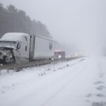
The National Weather Service (NWS) has issued a snow warning for parts of the United States next week, signaling the arrival of the season’s first major snowfall across several regions.
According to meteorologists, areas in the Pacific Northwest, Northeast, and portions of the Midwest could experience significant snow accumulation as a new cold front moves across the country. The storm system is expected to develop over the weekend and strengthen early next week, bringing colder temperatures, high winds, and wintry precipitation to multiple states.
“Happy November all. Nice to open the weather discussion with something besides tropical weather… The pattern is going to be pretty progressive over the next 7 days with a nice COLD dump in the east (likely coldest yet) for early next week on the heels of an amplified trough,” veteran meteorologist Jim Cantore wrote on social media. “Northwest and northeast should see some SNOW over the period which is nothing out of the ordinary.”
Also Read
Safety Preparations and Warnings
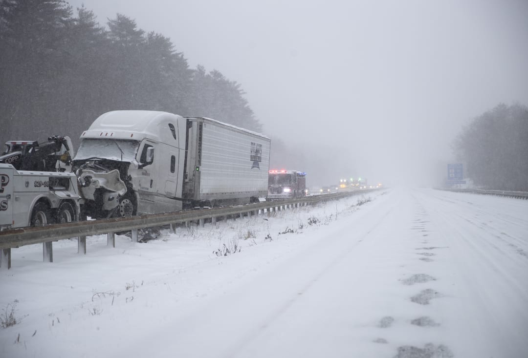
The NWS urged residents to begin preparing for winter conditions by checking heating systems, weatherproofing homes, and ensuring vehicles are equipped with emergency kits. Officials reminded drivers that the first snowfall of the season can often catch people off guard, leading to dangerous road conditions and accidents.
“With the first snowflakes of the season possible next weekend into early next week, it’s never too early to start planning for the winter season,” the NWS said in a statement. “Be prepared by taking steps to winterize your home and have an emergency kit in your vehicle.”
The agency emphasized the importance of checking local forecasts frequently, as snow totals and timing could vary depending on how the storm system develops.
Winter Safety Tips
Authorities offered the following reminders to stay safe during snow events:
-
Avoid driving unless absolutely necessary. If you are trapped in your car during a storm, stay inside, run the engine occasionally for warmth, and keep the exhaust pipe clear of snow.
-
Limit outdoor exposure to prevent frostbite and hypothermia. When outside, wear several layers of warm clothing, hats, and gloves.
-
Use caution while shoveling snow, as the cold combined with overexertion can increase the risk of a heart attack. Take frequent breaks and push snow instead of lifting it when possible.
-
Keep emergency supplies handy, including blankets, flashlights, batteries, water, and non-perishable food.
What to Expect
Meteorologists say that higher elevations in the Cascades and northern Rockies may receive the heaviest snowfall first, with lighter snow likely spreading eastward into the Great Lakes and interior Northeast by early next week. Temperatures in some areas are expected to drop 15–20 degrees below normal, marking the coldest weather of the season so far.
While the snowfall is typical for this time of year, officials urge residents to use caution as the transition from fall to winter driving can be unpredictable. Even minor snow accumulation can cause slippery roads, reduced visibility, and delays in travel.
The National Weather Service will continue to monitor the evolving system and issue updated advisories or warnings as the storm approaches. Residents are encouraged to follow local weather updates and stay informed through trusted sources.