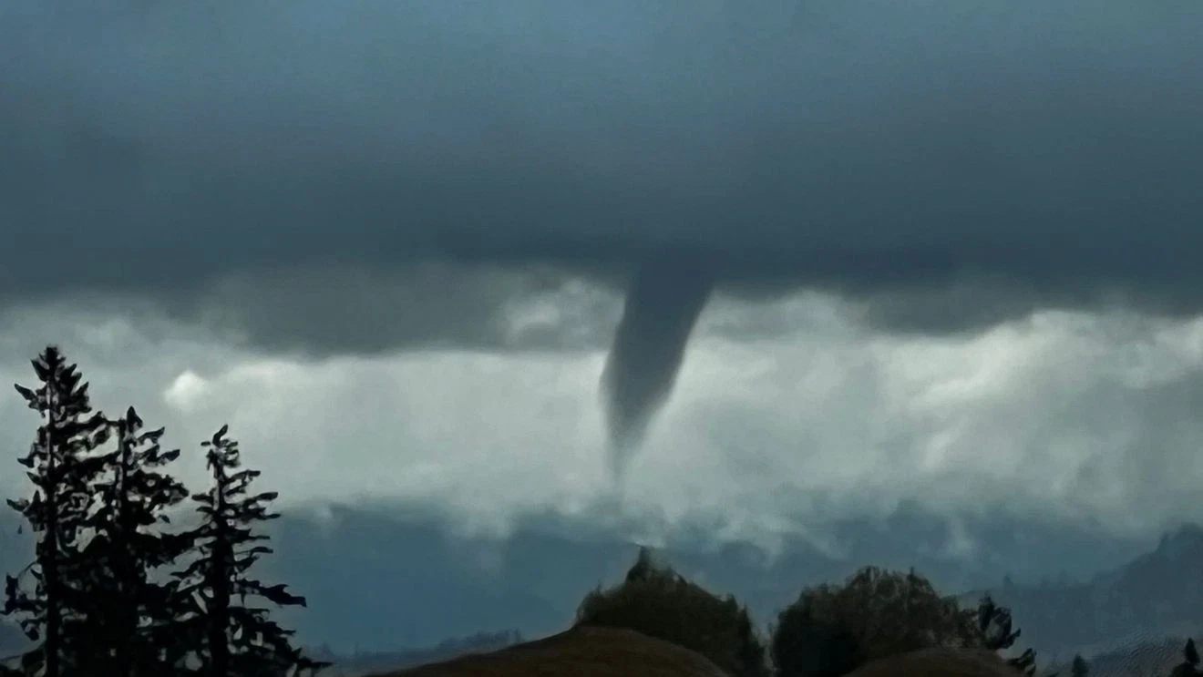
Residents across parts of Clackamas and Washington counties were urged to take precautions Sunday afternoon after the National Weather Service (NWS) in Portland issued multiple Special Weather Statements warning of a possible landspout tornado forming in the region.
The first advisory, issued shortly after 5 p.m., covered Tigard, Lake Oswego, and Oregon City, and remained in effect until 5:45 p.m.. Later, the NWS extended a second warning through 6:30 p.m. for Oregon City, West Linn, and Gladstone, as atmospheric conditions remained favorable for landspout formation.
What Is a Landspout?
According to the National Weather Service, a landspout is a non-supercell tornado — a weaker type of twister that can still produce dangerous winds, flying debris, and localized damage.
Also Read
“Landspouts can occur in cumuliform clouds without the parent cloud rotating,” the NWS explained. “They typically form along weather boundaries where air converges under weak vertical rotation. The rising air stretches and intensifies that rotation, increasing its spin.”
While landspouts are generally less powerful than classic tornadoes produced by supercell thunderstorms, they can still pose a threat to anyone outdoors, especially near open fields or unstable structures.
Residents Advised to Take Shelter
Meteorologists urged people in the affected areas to seek shelter in sturdy buildings as a precaution. Even though no confirmed landspout touchdown was reported, the potential for rotating clouds and gusty winds prompted warnings for residents to stay alert.
“When you hear the term ‘landspout,’ it’s easy to dismiss it as minor,” said one NWS meteorologist. “But these small tornado-like formations can still cause harm, particularly if debris gets lifted into the air.”
Local authorities and emergency services did not report any major injuries or property damage as of Sunday evening.
Unstable Weather Across the Portland Metro Area
Sunday’s unusual weather came as a result of unstable atmospheric conditions, with warm surface air meeting cooler air aloft. The convergence of these air masses created ideal conditions for brief, localized updrafts, which can sometimes spin up into landspouts.
Residents in Oregon City and West Linn reported seeing low, rotating clouds and swirling dust near open areas, though no tornado warnings were officially issued.
The NWS said it would continue to monitor radar and field reports through the evening to confirm whether any funnel clouds touched down.
Stay Weather-Aware
Meteorologists remind Oregonians that even in the fall season, brief severe weather events can occur when warm and cold fronts interact.
The NWS advises residents to:
-
Monitor local weather alerts through trusted sources.
-
Avoid open areas during sudden storms.
-
Seek shelter indoors if rotation or funnel clouds are spotted.
While Sunday’s landspout threat eventually subsided, it served as a reminder that even the Pacific Northwest — better known for its rain than its twisters — isn’t immune to the occasional tornado-like surprise.